Sheet A-7-CEUS-SSC Project GIS Data Summary
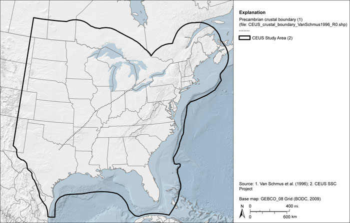
Precambrian Crustal Boundary by Van Schmus et al. (1996)
Download: ![]() Download GIS Data |
Download GIS Data | ![]() Download PDF Figures for Technical Use
Download PDF Figures for Technical Use
Data Files: CEUS_crustal_boundary_VanSchmus1996_R0.shp
Data Description: Data set representing the inferred eastern limit of pre-1,600 million-year-old continental crust. Extends from southeastern Oklahoma to southwestern Ontario.
Source (Internet URL, CD/DVD-ROM): Digitized after Fig. 2 in Van Schmus et al. (1996).
Author/Publisher/Year: Van Schmus, W.R., Bickford, M.E., Turek, A., 1996, Proterozoic geology of the east-central mid-continent basement: in van der Pluijm, B.A., and Catacosinos, P.A. (editors), Basement and Basins of Eastern North America: Boulder, Colorado, Geological Society of America Special Paper 308, pp. 7-32.
Data Summary: This layer was digitized at a scale of 1:1,650,000 from authors’ source figure (Fig. 2) with a published scale of approximately 1:14,085,000. Data are presented as an ESRI line shapefile.
Disclaimer or Constraints on Use: No constraints have been identified.
Figure A-7
Precambrian crustal boundary after Van Schmus et al. (1996)